Cervinia · Matterhorn · Panorama

Provider panorama/video player. Capture time is shown by the camera.
Open camera page ↗
Each colour starts at the value shown. Wind colours match across all three units. Dry cells stay neutral. Colours describe the displayed values, not official weather warnings.
GFS · Model run: · Updated on this site: · 4 model runs daily.Next update expected:
Day Local time Temp. (°C) Humidity (%) Wind (km/h) Wind (knots) Wind (Bft) Direction Rain (mm) Snow (cm) Pressure (hPa) Freezing (m) Conditions | Friday, 13/11 06 2.4 95 15 8 3B NW 0 0 999 2216 Clear  09 3.2 93 13 7 3B NW 0 0 1002 2208 Clear 12 3.5 76 12 6 2B NW 0 0 1004 2200 Clear 15 0.1 78 9 5 2B N 0 0 1009 1741 Clear 18 -3.5 34 5 3 1B N 0 0 1015 1228 Clear 21 -3.1 29 3 2 1B E 0 0 1017 1282 Clear Saturday, 14/11 00 -3.8 68 4 2 1B SE 0.02 0 1020 1177 Clear 03 -3.4 70 4 2 1B SE 0.01 0 1020 1243 Clear 06 -3.7 75 4 2 1B S 0.03 0 1022 1194 Clear 09 1.2 81 8 4 2B S 0.01 0 1020 1905 Clear 12 2.2 84 8 4 2B SE 0.09 0 1019 2062 Chance of rain  15 -0.3 93 11 6 2B SE 0.02 0 1021 1691 Clear 18 -1.7 95 13 7 3B SE 0.02 0 1024 1493 Clear 21 -0.5 96 13 7 3B SE 0.07 0 1023 1677 Light snowfall  Sunday, 15/11 00 -0.8 97 11 6 2B SE 0.11 0 1022 1632 Light snowfall 03 -1 96 11 6 2B S 0.18 0 1021 1601 Light snowfall 06 0 93 4 2 1B S 0.15 0 1020 1759 Light snowfall 09 2.2 87 6 3 1B S 0.01 0 1018 2072 Clear 12 3.7 89 6 3 2B S 0.02 0 1015 2257 Clear 15 1.3 93 8 4 2B S 0.02 0 1017 1950 Clear 18 -0.9 94 7 4 2B S 0 0 1018 1617 Clear 21 -1.1 94 8 4 2B S 0.01 0 1018 1586 Clear Monday, 16/11 00 -1.9 94 8 4 2B S 0.02 0 1019 1459 Clear 03 0.5 94 5 3 1B W 0.62 0.2 1015 1835 Snowfall 06 0 96 8 5 2B NW 0.70 0.2 1015 1761 Snowfall 09 3.1 90 11 6 2B W 0.78 0 1014 2235 Light rain  12 4.6 74 10 6 2B W 0.05 0 1013 2371 Chance of rain 15 2.1 87 9 5 2B NW 0 0 1015 2126 Clear 18 -0.7 68 5 3 1B NW 0 0 1018 1841 Clear 21 -0.5 72 4 2 1B W 0 0 1017 1682 Clear Tuesday, 17/11 00 0.2 74 6 3 2B SW 0 0 1015 1790 Clear 03 0.4 73 9 5 2B S 0 0 1014 1816 Clear 06 1 77 14 8 3B S 0 0 1011 1917 Clear 09 3.1 85 16 9 3B S 0.02 0 1008 2245 Clear 12 2.7 97 9 5 2B S 3.8 0 1006 2166 Rain 15 3.9 97 9 5 2B W 5.0 0 1004 2356 Rain 18 3 98 7 4 2B NW 0.78 0 1004 2401 Light rain 21 0.4 85 6 3 2B SW 0.04 0 1005 1933 Clear Wednesday, 18/11 00 -1.8 76 8 4 2B SW 0 0 1006 1475 Clear 03 0 96 8 4 2B W 1.3 0.4 1003 1761 Snowfall 06 -0.9 97 14 8 3B NW 6.1 1.9 1004 1618 Heavy snowfall 09 0.8 92 13 7 3B NW 0.89 0.3 1004 1873 Snowfall 12 1.4 93 13 7 3B NW 1.3 0 1002 1950 Snowfall 15 0.9 97 11 6 2B NW 2.4 0.7 1003 1888 Snowfall 18 0.1 97 10 6 2B NW 3.6 1.4 1005 1778 Heavy snowfall 21 -0.1 97 10 6 2B W 4.2 1.7 1006 1743 Heavy snowfall Thursday, 19/11 00 -0.1 97 11 6 2B NW 3.7 1.5 1007 1736 Heavy snowfall 03 -0.3 96 13 7 3B NW 3.6 1.4 1008 1719 Heavy snowfall 06 -0.3 97 13 7 3B NW 3.5 1.4 1009 1714 Heavy snowfall 09 0.9 97 15 8 3B NW 3.1 1.3 1010 1894 Heavy snowfall 12 1.5 95 13 7 3B NW 2.0 0 1012 1987 Snowfall 15 0.1 97 13 7 3B NW 0.41 0.1 1016 1867 Snowfall 18 -3.3 85 6 3 2B N 0.02 0 1020 1254 Clear 21 -1.7 55 3 2 1B S 0.01 0 1017 1496 Clear Friday, 20/11 00 1.1 68 10 5 2B S 0.30 0.1 1014 1931 Light snowfall 03 0.9 95 9 5 2B S 3.1 1.2 1015 1892 Heavy snowfall 06 1.1 97 4 2 1B SW 5.6 2.2 1014 1923 Heavy snowfall 09 3 97 9 5 2B SW 4.1 0 1012 2207 Rain 12 3.4 91 12 7 3B W 1.6 0 1012 2392 Light rain 15 0.5 98 11 6 2B W 0.07 0 1015 1834 Light snowfall 18 -0 97 12 7 3B NW 0.36 0.1 1019 1776 Snowfall 21 -2 96 14 8 3B NW 0.10 0 1022 1456 Light snowfall Saturday, 21/11 00 -1.5 94 16 9 3B NW 0 0 1024 1521 Clear 03 -3.6 95 15 8 3B NW 0.02 0 1026 1207 Clear 06 -3 93 15 8 3B NW 0 0 1026 1296 Clear 09 -0.3 88 13 7 3B NW 0 0 1025 1726 Clear 12 2.2 82 13 7 3B NW 0 0 1023 2208 Clear 15 -0.6 71 10 5 2B NW 0 0 1025 1772 Clear 18 -2.5 46 7 4 2B N 0 0 1027 1374 Clear 21 -2 39 3 2 1B N 0 0 1027 1443 Clear Sunday, 22/11 00 -0.7 43 1 1 1B E 0 0 1025 1652 Clear 03 -1.5 40 2 1 1B N 0 0 1025 1527 Clear 06 0.1 46 2 1 1B NW 0 0 1024 1774 Clear 09 3.7 60 4 2 1B SW 0.09 0 1022 2343 Chance of rain 12 3.2 79 5 2 1B W 0.26 0 1022 2239 Chance of rain 15 2.8 96 4 2 1B SW 0.97 0 1021 2196 Light rain 18 1.9 98 5 3 1B S 1.1 0 1021 2052 Snowfall 21 2.1 98 6 3 2B NW 4.5 0 1021 2085 Rain Monday, 23/11 00 0.9 97 12 6 2B NW 4.3 1.7 1023 1911 Heavy snowfall 03 -0.5 97 14 7 3B NW 0.26 0.1 1024 1680 Light snowfall 06 -1.4 94 14 8 3B NW 0.07 0 1025 1545 Light snowfall 09 -0 83 11 6 2B NW 0 0 1025 1847 Clear 12 2.4 81 10 6 2B NW 0 0 1022 2269 Clear 15 -1 81 10 6 2B NW 0 0 1024 1818 Clear 18 -3.8 41 7 4 2B N 0 0 1026 1166 Clear 21 -3.7 34 5 3 1B N 0 0 1025 1190 Clear Tuesday, 24/11 00 -3.7 36 5 2 1B N 0 0 1024 1185 Clear 03 -3.9 37 5 3 1B N 0 0 1023 1163 Clear 06 -4 36 5 3 1B NW 0 0 1023 1147 Clear 09 1.4 56 5 3 1B NW 0 0 1019 1975 Clear 12 4.3 59 5 3 1B NW 0 0 1016 2431 Clear 15 -0.4 60 5 3 1B NW 0 0 1018 1690 Clear 18 -2.5 42 5 3 1B NW 0 0 1020 1381 Clear 21 -1.7 46 3 2 1B NW 0 0 1019 1495 Clear Wednesday, 25/11 00 -2.6 46 4 2 1B NW 0 0 1020 1357 Clear 03 -2.9 48 3 2 1B N 0 0 1019 1307 Clear 06 -1.6 58 3 2 1B N 0.02 0 1017 1507 Clear 09 2.1 64 2 1 1B S 0 0 1013 2081 Clear 12 2.7 78 7 4 2B SE 0 0 1011 2184 Clear 15 -0.2 92 10 5 2B SE 0.01 0 1013 1734 Clear 18 -0.6 95 10 6 2B SE 0.23 0 1012 1659 Light snowfall 21 -1.9 97 10 5 2B S 0.20 0 1012 1461 Light snowfall Thursday, 26/11 00 -3.3 97 6 3 2B S 0.09 0.1 1012 1249 Light snowfall 03 -1.7 96 2 1 1B SW 0.40 0.1 1009 1493 Snowfall 06 -1.1 96 2 1 1B NW 0.94 0.3 1006 1586 Snowfall 09 -0.2 93 4 2 1B W 0.56 0.2 1004 1728 Snowfall 12 1.5 87 5 3 1B SW 0.06 0 1001 1987 Light snowfall 15 -2 96 3 2 1B S 0.02 0 1004 1447 Clear 18 -3.8 98 5 3 1B S 0.35 0.3 1005 1177 Snowfall 21 -2.7 95 6 3 2B W 1.3 0.4 1005 1344 Snowfall Friday, 27/11 00 -5.7 91 6 3 2B SW 0 0 1009 887 Clear 03 -4.6 71 6 3 2B S 0 0 1008 1052 Clear 06 -3.3 61 10 5 2B S 0 0 1007 1257 Clear 09 -0.8 75 14 8 3B S 0 0 1006 1635 Clear 12 0.2 93 16 9 3B SE 0.22 0 1005 1797 Light snowfall 15 0.3 97 19 10 3B SE 0.37 0.1 1004 1804 Snowfall 18 -1.3 96 17 9 3B SE 2.6 0.8 1006 1564 Snowfall 21 -0.1 96 16 8 3B SE 1.1 0.3 1003 1736 Snowfall Saturday, 28/11 00 -0.2 96 15 8 3B SE 2.5 0.8 1002 1728 Snowfall 03 0.6 96 17 9 3B SE 2.0 0.6 997 1853 Snowfall 06 0.1 97 14 8 3B SE 6.1 2.4 996 1781 Heavy snowfall 09 0.7 97 13 7 3B S 1.8 0.5 996 1870 Snowfall 12 1.2 92 8 4 2B SW 2.0 0 998 1937 Snowfall 15 -2.3 97 4 2 1B W 0.24 0 1001 1411 Light snowfall 18 -4.9 90 4 2 1B N 0.10 0.1 1006 1010 Light snowfall 21 -6.3 75 1 0 0B SW 0 0 1009 792 Clear Sunday, 29/11 00 -6.9 77 2 1 1B SE 0 0 1011 702 Clear 03 -6.8 82 5 2 1B SE 0 0 1011 728 Clear 06 -7 88 6 3 2B S 0 0 1012 706 Clear |
|---|
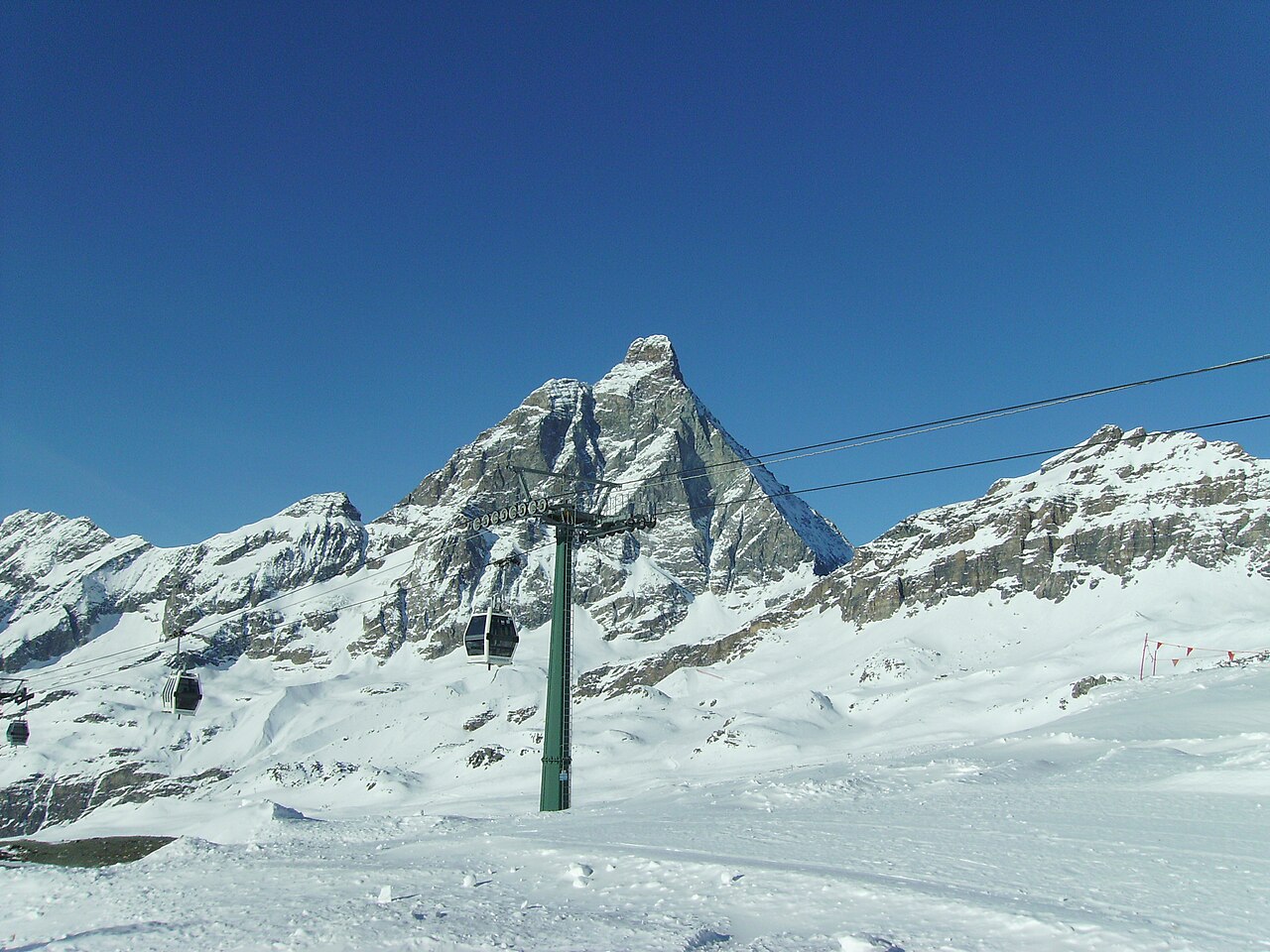
Breuil-Cervinia is the Italian starting point for skiing beneath the Matterhorn, known here as the Cervino. Its linked area includes Valtournenche and the Swiss resort of Zermatt. This is a cross-border ski area with several bases, not a descent from the summit of the Matterhorn: the mountain’s height should not be mistaken for the height of a ski lift or piste.
The forecast point on this page is at 2,023 m. That represents the lower resort rather than Plateau Rosà or the upper connections. A webcam showing snow high on the glacier can therefore be consistent with a warmer forecast here. To assess the day you intend to ski, choose the relevant mountain elevation and follow wind and temperature as well as snowfall.
The Italian operator publishes separate lift and piste information for Breuil-Cervinia, Valtournenche and Zermatt. Check the actual international connection before making it part of your itinerary, including the return. A lift marked as scheduled to open is not the same as an operating lift. For arrival and departure days, also look at the lower-elevation forecast along your route instead of relying only on the mountain outlook.
Official sources: Cervino Ski Paradise — skiing · Cervino Ski Paradise — lifts and pistes. Reviewed 18 October 2026.
Provider panorama/video player. Capture time is shown by the camera.
Open camera page ↗